Around Larnas
LARNAS
Around Larnas
Medium
3h30
11,9km
+233m
-236m
Loop
GR
PR
Embed this item to access it offline
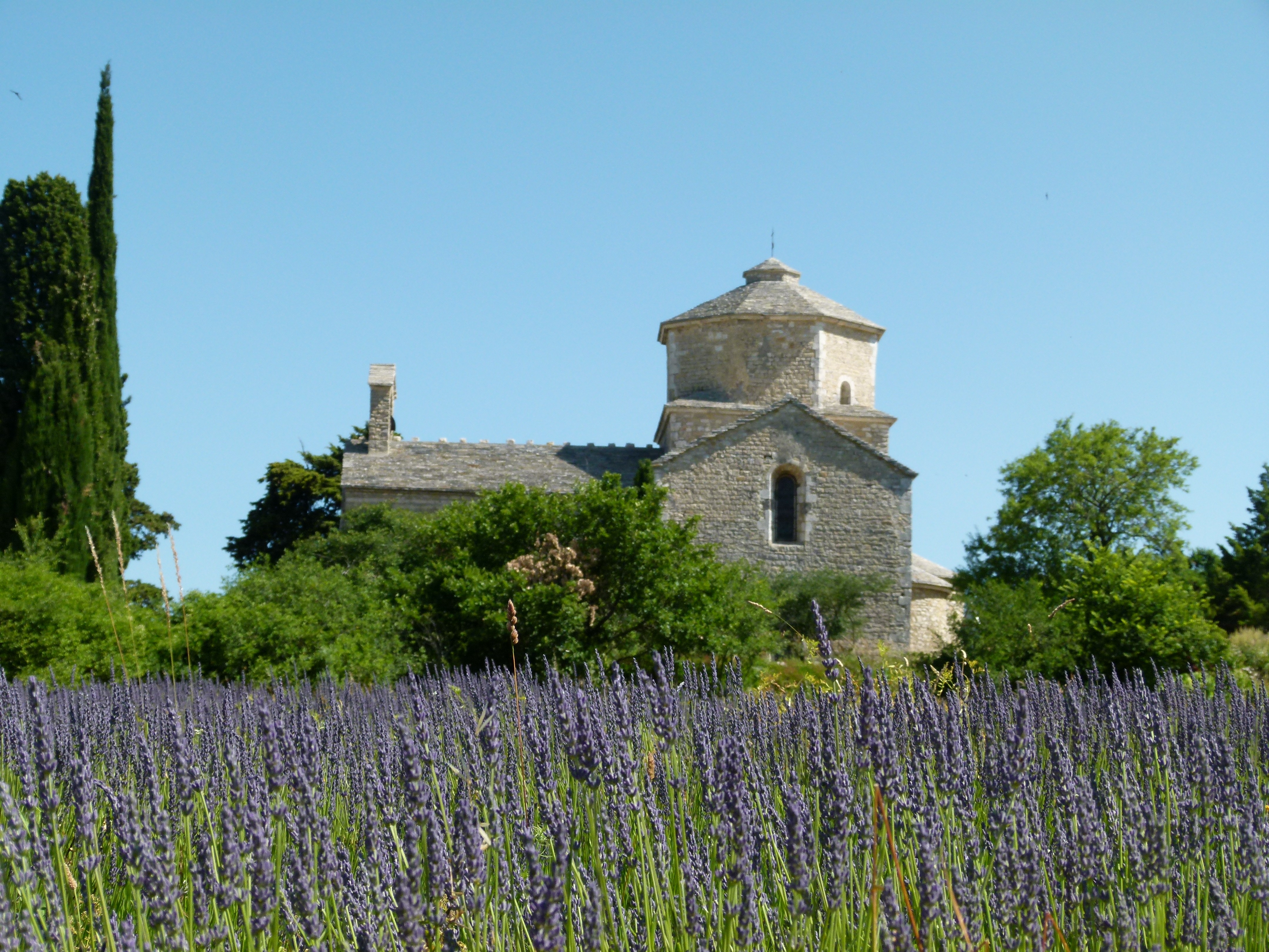
A beautiful, varied circuit, both in terms of the paths taken and the landscapes: sometimes intimate, sometimes open. Very beautiful views of the lavender plateau, the Dent de Rez, valleys and wooded ridges.
Description
- When you are facing the hiking information sign, next to Larnas Town Hall, turn right and pass St. Pierre Church (worth visiting). Follow the markings. Go up the small road until you reach the high-voltage lines. At a power pole, leave the road and take the path on the right. Do not turn right towards the pylons or left towards the road. Continue on this path until you reach the "Bois de Deniéret" pole.
- There, head towards Viviers and follow the path that descends through the forest. When you reach a hunter's cabin, turn left towards the paved road and left onto it.
- At the farm on a ridge, continue straight ahead (you leave the markings to continue on the PR); and, at the fork shortly after, do not go left towards Larnas but take the dead-end road in front of you. At the end of this road, go straight ahead and take the path that crosses the forest. When it opens onto a wider path, turn left.
- At the next junction (about 400m further): "Gandaubert" signpost. Turn left towards Larnas - Fontaine du Buis. Stay on this track until you reach a paved road. From the crossroads, there is a beautiful viewpoint over the Nègue Valley on the right.
- Take the road to the left for 80m then turn right onto the uphill path. Continue on this path, and at the second intersection, turn right following the PR markings.
- Turn left onto the paved road; and, 270m further, turn right onto the path crossing the lavender fields. Stay on this path for about 900m,
- turn left onto a path between two drystone walls (called clapas). Continue along this path, which continues along a paved road, to the intersection with the D262. Cross.
- At the crossroads, signpost "Fontaine des Buis," follow signs for St-Montan. Stay on the wide path that climbs.
- At the signpost "Bas Rocher." Follow the shaded path towards Larnas, 1.1 km via La Peyrière.
- At the signpost "La Peyrière." Follow signs for "Larnas 0.7 km," taking the marked path on the left. Continue on this path. You may have to go through a barrier to continue straight ahead at the end of the descent (do not go uphill on the left). In the village, pass the fountain, then under the arch to reach the town hall.
- Departure : Hiking information panel - Larnas town hall
- Arrival : Hiking information panel - Larnas town hall
- Towns crossed : LARNAS, SAINT-MONTAN, and GRAS
Forecast
Altimetric profile
Information desks

Place du Champ de Mars, 07700 Bourg-Saint-Andéol
Le Village, 07220 Larnas

5 place Riquet, 07220 Viviers
Access and parking
From Viviers, take the D86 south, then the D262 towards Saint-Montan. Go through the village and continue on the D262 through the Sainte-Baume Gorges to Larnas.
From Vallon-Pont-d'Arc, take the D4 towards Saint-Remèze, then the D262 towards Larnas.
From Saint-Martin-d'Ardèche, join the D86 then pass through Saint-Just-d'Ardèche; bypass Bourg-Saint-Andéol, and at the roundabout at the end of the bypass, take the second exit and then the first road on the right: the D190 to Saint-Montan, then the D262 to Larnas.
Parking :
Car park behind the town hall of Larnas
Report a problem or an error
If you have found an error on this page or if you have noticed any problems during your hike, please report them to us here: