The Cirque de Gens from Ruoms
This hike includes a steep, slippery descent and steep sections over rocks and pebbles. Be VERY CAREFUL, especially with children, when passing overhanging cliffs.
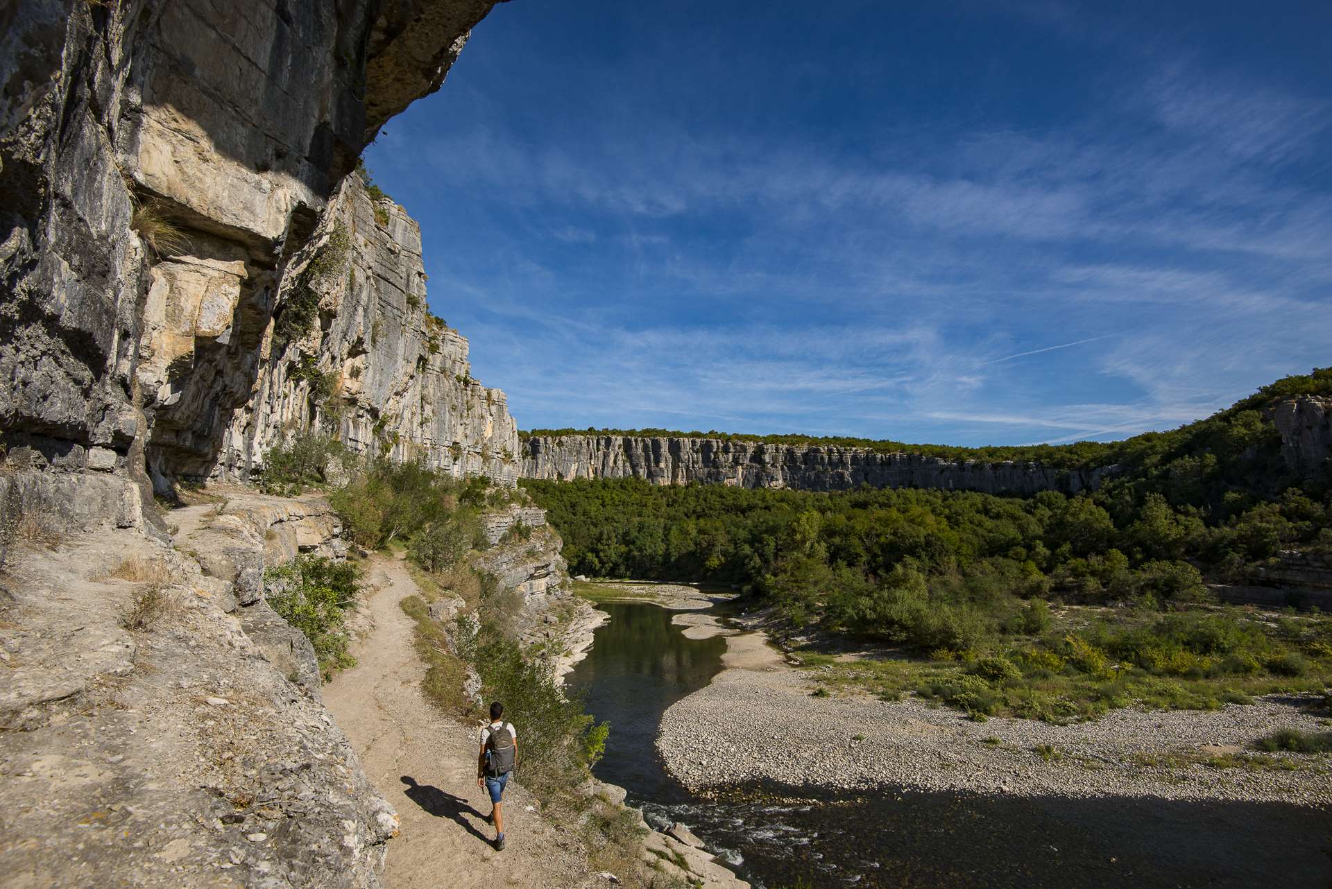
Green path, spectacular viewpoints of a circus of limestone cliffs and the Ardèche river. Paths along the water and at the foot of the cliffs; or between dry stone walls in the undergrowth. And all this amid Mediterranean vegetation.
Description
When you are opposite the Ruoms tourist office, turn right onto rue Millerand (towards Résidence le Méridien) for 300 m. Always follow the signs
- At the hiking signpost, turn left onto the Via Ardèche greenway for pedestrians and cyclists, signposted "Pradons".
- At the "Le Champ du Gras" signpost, follow "Pradons 2.1 km" and stay on the greenway for another 600 m.
- At the "Les petites Pièces" signpost, follow "Cirque de Gens 4.6 km". Leave the voie verte to the left and take a small tarmac road as far as the hamlet of Mas du Grazel, where the road becomes a footpath leading down through the trees to the River Ardèche. The path takes you over large rocky slabs along the river. Around 300 m further on, a small sandy beach is well worth the diversions (100 m round trip to the right). The footpath then climbs back up to the middle of the cliff, overlooking the river. Be very careful here, especially with children!
- Don't go straight ahead at the bend, but take the path leading downwards. Then follow the edge of the river over rocky slabs (impassable when the river is in flood). The vegetation gradually replaces the rocks.
- Where the Ligne meets the Ardèche, the path climbs back up and passes close to the Beaume Grenas cave. If you have a torch, take a look - it's well worth the diversions! Then continue to climb and follow the path lined with walls to the Les Carrières junction.
- At the "Les Carrières" signpost, follow the signs for "Ruoms 2.4 km". The path widens at the old quarry buildings. You then come to a tarmac road. At the next junctions, continue along the main road until you reach the greenway. At the "Le Champ Du Gras" post (2), follow "Ruoms 1.2 km" to the right on the "Via Ardèche" greenway. At the "Le Champ du Four" post (1), follow "Info Rando 0.2 km" to the right. Rue Président Millerand will take you back to the starting point.
- Departure : Tourist Office - 9 rue Alphonse Daudet, 07120 Ruoms
- Arrival : Tourist Office
- Towns crossed : RUOMS
Forecast
Altimetric profile
Recommandations
In fine weather, bring your swimsuit and enjoy the small sandy beach in the heart of the campsite, opposite the cliffs. It is a pleasant and refreshing place to swim.
Heritage lovers can visit the old part of Ruoms with its beautiful church. 6 towers mark the site of the old city walls.
Possibly water shoes and torch or headlamp.
Information desks

9 rue Alphonse Daudet, 07120 Ruoms
Transport
"Déviation" stop along the D579 about 450 m from the start of the walk.
Bus line E15 Aubenas - Avignon
Coach line X76 Valence TGV / Montélimar / Vallon Pont d'Arc
Access and parking
From Aubenas, take the D579 towards Vogüé, Gorges de l'Ardèche as far as Ruoms.
From Vallon-Pont-d'Arc, take the D579 towards Aubenas as far as Ruoms.
From Alès, take the D104 towards Aubenas. Then take the D111 towards the Gorges de l'Ardèche and 2 km after the large bridge turn left onto the D579 as far as Ruoms.
Parking :
Report a problem or an error
If you have found an error on this page or if you have noticed any problems during your hike, please report them to us here: