The Dolmen du Chanet, between nature and history
SAINT-REMEZE
The Dolmen du Chanet, between nature and history
Medium
2h30
6,2km
+277m
-277m
Loop
PR
Be sure to check the weather conditions before setting off, as some sections are slippery.
Embed this item to access it offline
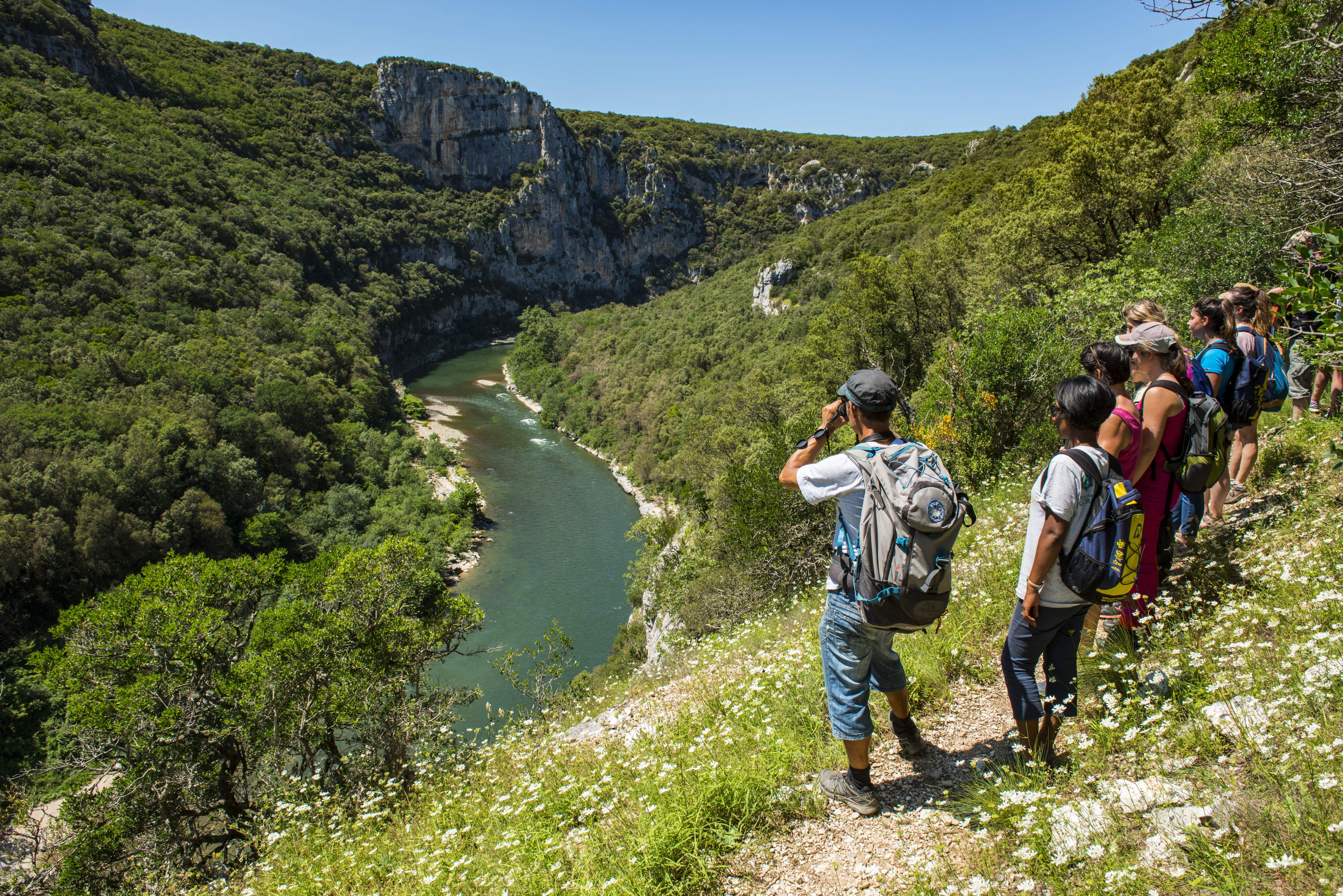
From the Maison Forestière de Saint-Remèze, this trail takes you to the heart of the Gorges de l'Ardèche nature reserve, where wild nature rubs shoulders with Neolithic remains. Through garrigue and holm oak forest, admire exceptional biodiversity before reaching the Chanet dolmen, ancestral evidence of the region's first farmers. Vertiginous cliffs, secret caves and breathtaking panoramas mark out this hike, rich in history and ideal for a walk!
Description
From the Maison Forestière de Saint-Remèze, follow the signs to the "Dolmen du Chanet".
The path crosses the thicket of holm oaks, so be careful not to get lost.
The path crosses the thicket of holm oaks, so be careful not to get lost.
- At the signpost "Aven du Cadet", go straight on towards the Bivouac de Gournier. You will then descend overlooking the large Autridge rock, inhabited by a colony of jackdaws. At the signpost "Chanet", follow the signs to "Dolmen du Chanet".
- Be careful when crossing the Route Touristique des Gorges de l'Ardèche. You are now entering the national nature reserve of the Gorges de l'Ardèche, so respect the regulations. 800 metres after the fork, you come to the Chanet dolmen, where there is an information panel. This is one of the few dolmens on the slopes of the Gorges. A pole indicates the landscape you can view in the direction of the dolmen. This landscape corresponds to the view of late prehistoric man. The path crosses a number of flat areas corresponding to charcoal pits, where scorched earth has prevented vegetation from growing back. The trees have been regularly felled, leaving only the appearance of dense coppice. Look out for rocks on the way down. Note the presence of Phoenician juniper and especially some stands of sage-leaved rock rose. Watch out until the next fork as the stones can be slippery.
- At the signpost "Aiguille de Gournier", follow the signs "Bivouac de Gournier"; walk along the Ardèche until you reach the beach of the Bivouac. The path takes you down to the Ardèche where grey wagtails are frequent, sometimes accompanied by dippers. At the bivouac's beach post, go straight on towards the Maison Forestière. At the bivouac, you can use the sanitary facilities, which are open during the summer months (Easter to September), and the water point. You can also spend the night there (book at the tourist office). In case of problems, an agent from the SGGA, which manages the reserve and bivouacs, is on site in summer.
- At the reception in Gournier, turn left towards the Route Touristique and follow the signs straight ahead. If you want to learn more about the fauna, flora, geology and landscapes of the Gorges de l'Ardèche, you can take a fun discovery trail at the bivouac! Take the path to the right of reception and follow the arrows. You can then walk back to reception and continue your hike. After the toilets, go straight on for about 200 metres. At the first bend, go straight ahead on the small path that leads to the concrete path used only by emergency services and Reserve vehicles.
- At the last post of the Barrière de Gournier, go straight on towards the Maison Forestière to complete the loop.
- Departure : Saint-Remèze Forest House
- Arrival : Saint-Remèze Forest House
- Towns crossed : SAINT-REMEZE
Forecast
Altimetric profile
Information desks

Place du Champ de Mars, 07700 Bourg-Saint-Andéol

16 rue des Abeilles, 07150 Vallon Pont d’Arc
Transport
Not served by public transport
Access and parking
Coming from Vallon-Pont-d'Arc, follow the Route des Gorges (D290) and once you have passed the Grotte de la Madeleine, turn left onto the D590 towards Saint-Remèze. At a fork in the road, take a dirt track on the left towards the Maison Forestière de Saint-Remèze. Go to the end of the track and park.
Coming from Saint-Martin-d'Ardèche, follow the D290 and take the D590. Itinerary in common with the text above
Coming from Saint-Martin-d'Ardèche, follow the D290 and take the D590. Itinerary in common with the text above
Parking :
Saint-Remèze Forest House
Report a problem or an error
If you have found an error on this page or if you have noticed any problems during your hike, please report them to us here: