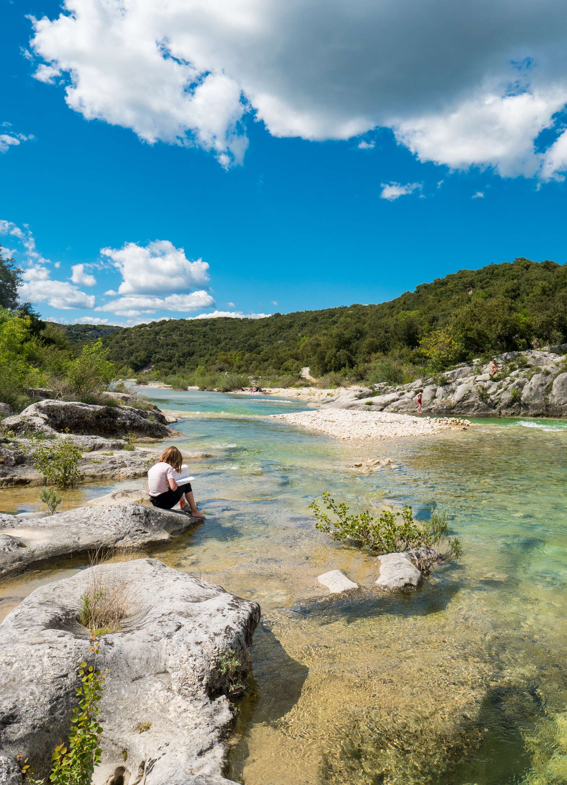
The Ibie balconies from Lagorce
LAGORCE
The Ibie balconies from Lagorce
Medium
2h45
8,3km
+266m
-265m
Loop
PR
Rocky, steep paths in places
Embed this item to access it offline
This trail combines a beautiful village clinging to a rocky ridge, passages along the banks of a river with crystal-clear turquoise water and then through a holm oak forest; a delicate stone arch at the top of steep slopes offering stunning views over the Ibie valley; and a botanical trail with nearly 200 species of Mediterranean plants.
Description
From the Info Rando sign in the car park in the centre of the
Follow the signs north. Follow the signs for "VERASOIE - Musée Magnanerie". This museum exhibits the most significant episodes in the history of silkworm rearing and shows the complete cycle of a silkworm farm.
Shortly before the museum, take a small passage on the right that zigzags downwards. Then continue down the narrow road until you reach a crossroads.
- At the signpost "Sous la Magnanerie", head south (right) towards "Ferrière". Stay on the road for just over 500 m, then take the "chemin de Ferrière" which goes off to the left. Stay on this path and do not take the left-hand paths.
- At the "Ferrière" post, take the track to the left, signposted "Bois ND d'Ajude". After skirting the river for 1.15 km, take the path that climbs to the left (the second one after the ford).
- After climbing for 1.15 km, take the path on the right. This is not signposted but is marked by one or more small cairns of piled stones. Walk back and forth as far as the delicate stone arch of the Ranc de l'Arc. Once back on the wide path, turn right and follow the markings. Stay on this ridge path and take the 4th path down to the left. Go straight on at the 1st junction and turn right at the 2nd. At the bottom of the valley, go up 10m to the right.
- At the "Bois de ND d'Ajude" sign, follow the signs for "Salastre (0.9km)/ Lagorce". Take the path that goes up to the left.
- From the Notre Dame d'Ajude chapel, continue on the path that leads back down to the road.
- At the "Salastre" signpost, follow the road to the left to get back to the "Sous la Magnanerie" signpost, from where you have to go back up to the right to the start, from where you can visit the beautiful village of Lagorce. Stroll through the narrow streets and climb up to the platform, which offers a beautiful panoramic view.
- Departure : Hiking information panel, place du 14 juillet, 07150 Lagorce
- Arrival : Hiking information panel, place du 14 juillet, 07150 Lagorce
- Towns crossed : LAGORCE
Forecast
Altimetric profile
Recommandations
Good footwear, water, sun protection, walking sticks if necessary, etc.
Information desks

9 rue Alphonse Daudet, 07120 Ruoms

16 rue des Abeilles, 07150 Vallon Pont d’Arc

52 Rue Grande Rue, 07200 Vogüé
Access and parking
From Vallon-Pont-d'Arc, take the D4 and then the D1.
From Bourg-Saint-Andéol, take the D4 and then the D1.
From Ruoms, take the D559 and then the D1 to the right.
From Vogüé, take the D579 and then the D1.
From Bourg-Saint-Andéol, take the D4 and then the D1.
From Ruoms, take the D559 and then the D1 to the right.
From Vogüé, take the D579 and then the D1.
Parking :
Place du 14 juillet or under the village
Report a problem or an error
If you have found an error on this page or if you have noticed any problems during your hike, please report them to us here: