The Monastier
VAGNAS
The Monastier
Easy
2h30
7,7km
+149m
-149m
Loop
PR
Embed this item to access it offline
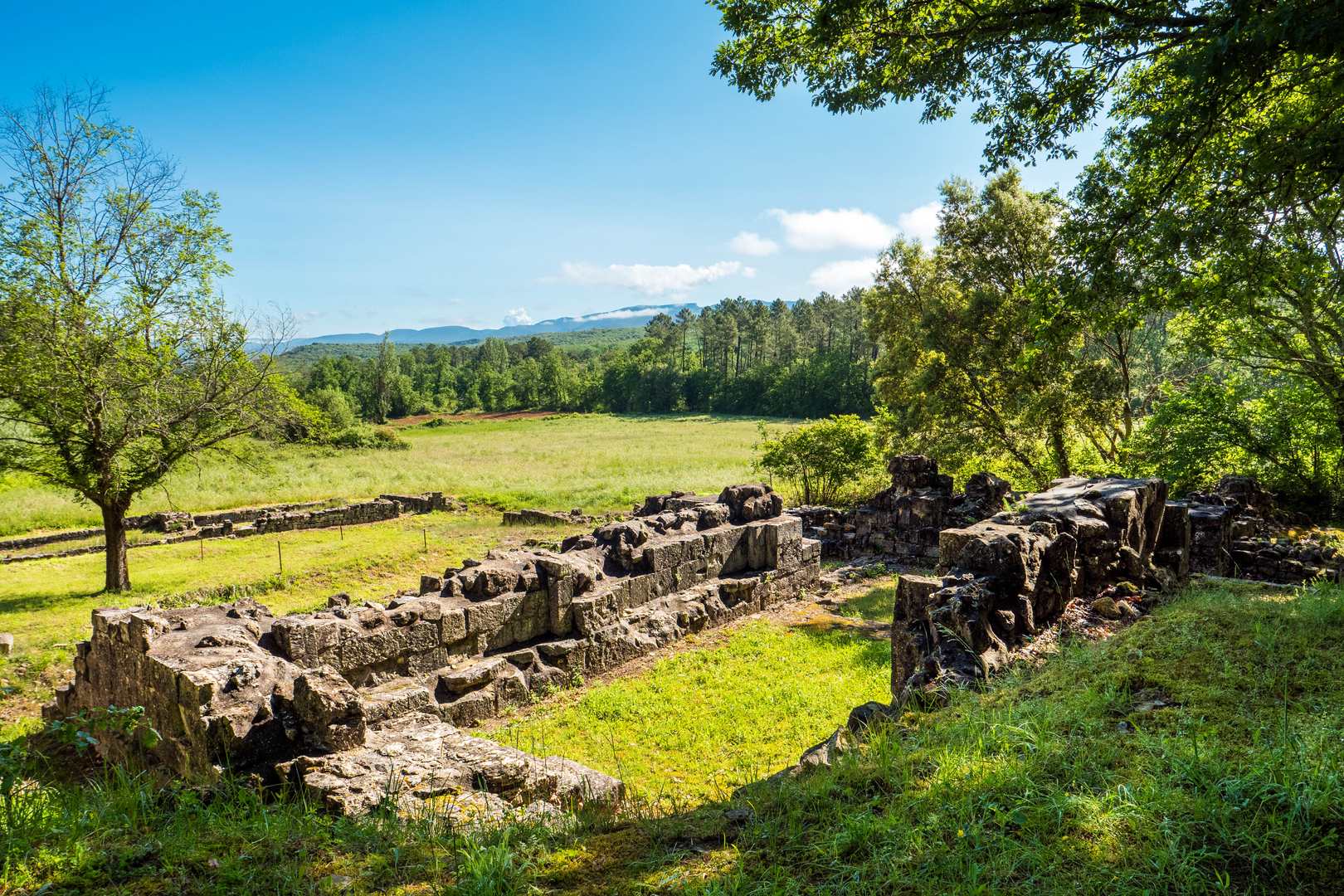
Discover Le Monastier, a 9th-century priory and its ruins, which trace sanctuaries from the Gallo-Roman to the Gothic period and were abandoned around 1300. The monks' washhouse, an inexhaustible resource, and the Roman Antonine road, the Alba-Nîmes axis, highlight the strategic importance of the site and its connection with the first Christians. An exceptional heritage in the Rieusset valley.
Description
- Depuis le panneau Info Rando situé à coté du cimetière, longer la mairie et au carrefour, tournez à gauche. Suivre la rue de l'École sur environ 120 mètres puis traverser la route, et suivre le panneau D255 Brujas - Bessas. Longer la route sur 600 mètres.
- Rejoindre l’embranchement Le Valadas. suivre Rieusset 4,2 km Continuer tout droit, puis environ 50 m après la montée, prendre à droite au croisement. Tourner à gauche vers « La voie Romaine » inscrit sur le poteau en bois. Contourner la propriété privée par la droite, puis suivre le chemin en lisière de forêt. Descendre sur 250 m environ avant d’arriver à l’embranchement Ruines du Monastier.
- A partir de cet embranchement, un aller- retour est possible jusqu’aux ruines du Monastier. Monastier. suivre Grand Chêne 2,1 km Salavas 8,9 km Continuer sur un étroit chemin qui mène à l’ancien lavoir des moines. Le sentier passe alors entre la source et le lavoir puis débouche sur une piste. Suivre la direction « Le Monastier Retour ». Après une descente sur un chemin assez caillouteux, poursuivre tout droit jusqu’au prochain embranchement Les Routes. suivre Grand Chêne 0,9 km Salavas 8 km Longer le ruisseau sur une trentaine de mètres avant d’arriver à un passage à gué. Traverser le ruisseau « Rieussec » et continuer sur ce chemin qui débouche sur une route goudronnée.
- S’engager sur la route à gauche et continuer jusqu’au carrefour Grand Chêne. Suivre Brujas 2,7 km. Continuer tout droit jusqu’à l’embranchement Champ Lacloque.
- prendre à gauche et suivre Vagnas 2,5 km A 300 m environ, traverser sur une étroite passerelle en bois et continuer tout droit jusqu’au hameau « Ségriès ». Passer devant la maison et continuer tout droit. Au bout de la ligne droite, quitter la route et prendre à gauche le sentier qui passe dans un bois. Il retombe 200 m plus loin sur un chemin goudronné parallèle à une route. Rattraper la route et prendre à gauche. Longer la route jusqu’à l’embranchement Le Valadas. suivre Vagnas 0,8 km Reprendre le même chemin qu’à l’aller pour rejoindre le point de départ.
- Departure : Hiking information panel - cemetery car park
- Arrival : Hiking information panel - cemetery car park
- Towns crossed : VAGNAS
Forecast
Altimetric profile
Recommandations
Drink plenty of water and protect yourself from the sun.
Good shoes and possibly walking sticks. Water bottle and hat.
Information desks

16 rue des Abeilles, 07150 Vallon Pont d’Arc
Access and parking
From Vallon-Pont-d'Arc, take the D579 towards Salavas. Stay on the same road. Go straight ahead after the traffic lights, then take the next exit on the left. Drive past the church and park in the town hall square. Take the first exit on the right and you will be back at the starting point.
Parking :
Church car park
Report a problem or an error
If you have found an error on this page or if you have noticed any problems during your hike, please report them to us here: